
Client: Self-Initiated
Design & Illustration: Jitesh Patel
Location: London, UK
Category: Illustrated Map, Travel & Cityscape Illustration


Overview
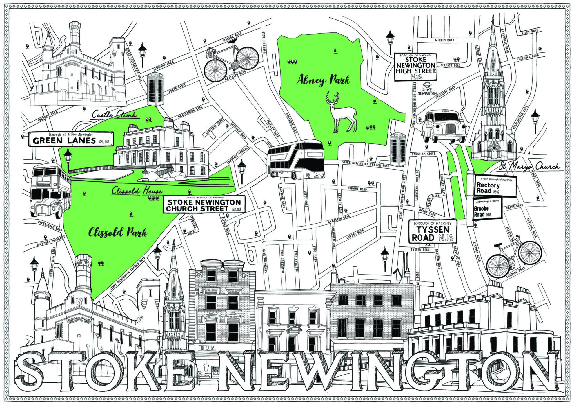
Stoke Newington, one of North London’s most characterful and eclectic neighbourhoods, was the focus of this self-initiated illustrated map project. The aim was to capture the area’s rich blend of historic architecture, independent businesses, and green spaces through a detailed black and white hand-drawn map, rendered in ink pen.
Approach
Inspired by a personal visit to Stoke Newington, I sought to reflect the area’s charm through expressive linework and thoughtful composition. The process began with on-location sketching and photo references to document key landmarks, local shops, cafes, restaurants, and iconic sights.
The illustration celebrates both the visual identity and community feel of the neighbourhood—designed to appeal to locals, visitors, and map lovers alike.
Design Details
The map centres on Stoke Newington’s lively high street and surrounding streets, weaving in a detailed network of:
-
Independent shops and boutiques
-
Local restaurants and cafes
-
Pubs and nightlife
-
Parks and green spaces like Clissold Park
At the base of the illustration, a bold architectural skyline highlights local icons such as:
-
Clissold House – an elegant Georgian mansion at the heart of the park
-
Castle Climbing Centre – a dramatic, turreted building now repurposed for indoor rock climbing
Hand-drawn transport icons and street signage enhance the map’s usability, offering a nod to navigation while maintaining its artistic sensibility.
Outcome
The Stoke Newington illustrated map serves as both an artistic homage and functional guide, inviting viewers to explore the area’s diverse attractions. Its monochrome pen style provides a timeless, tactile aesthetic that aligns with the neighbourhood’s mix of heritage and creativity.
This piece is part of a broader personal series documenting London neighbourhoods through illustrated travel maps—each one a celebration of place, detail, and identity.


