

Client: Personal Project
Design & Illustration: Jitesh Patel
Location: Royal Borough of Greenwich, London
Category: Map Illustration


Overview
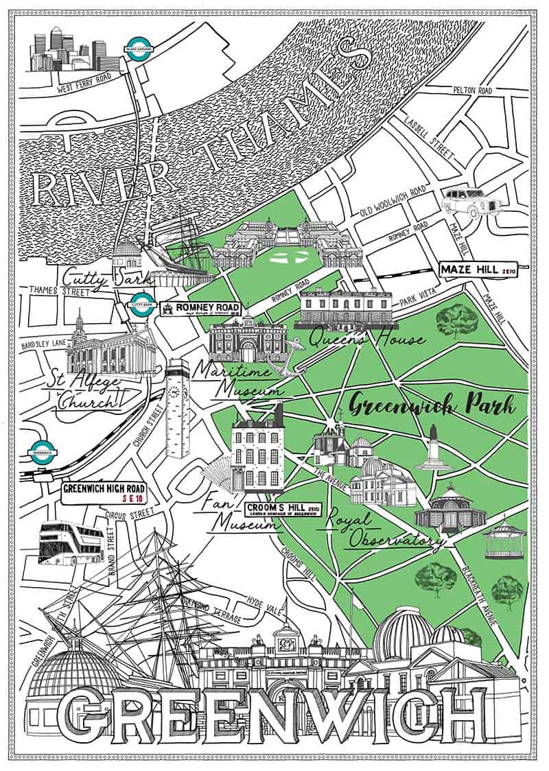
This illustrated map of the Royal Borough of Greenwich is part of a wider series capturing London’s iconic neighbourhoods through expressive, hand-drawn cartography. Known for its rich maritime heritage, architectural landmarks, and vibrant cultural life, Greenwich is a unique and historically layered part of London. The map celebrates these qualities, offering a visual guide to key destinations across Greenwich and neighbouring Blackheath.
Approach
Developed from an initial sketch in my Moleskine city map series, this map was a personal exploration of Greenwich’s heritage, community, and geography. The aim was to produce a piece that not only guides viewers but also conveys the borough’s unique character and atmosphere—balancing historical gravitas with contemporary vibrancy.
Design Details
The map features a finely rendered street grid overlaid with black and white spot illustrations of key landmarks. Each site is carefully selected and drawn by hand to capture its unique architectural and cultural essence. Highlights include:
-
The Cutty Sark – iconic 19th-century tea clipper
-
Royal Naval Hospital – a masterpiece by Sir Christopher Wren
-
The Queen’s House and Maritime Museum – nestled within Greenwich Park
-
St Alfege Church, The Clock Tower, and The Fan Museum
-
Royal Observatory and General Wolfe Statue – perched above the Prime Meridian
-
Greenwich Market, Bandstand, and local cafés – reflecting modern life in the borough
Each illustration is labelled for clarity, while a stylised Greenwich skyline at the base of the map provides a dramatic visual anchor and celebrates the borough’s architecture.
Outcome
The Royal Borough of Greenwich map invites viewers to discover this historic corner of London at a glance. Designed to be both informative and visually rich, it offers a snapshot of key destinations and moments of charm. As part of my broader map series—including Peckham, Stoke Newington, and Central London—this piece contributes to a growing visual archive that documents the essence of London neighbourhoods through illustrated storytelling.


